
Landing zones are where hesitation gets expensive
When a helicopter medical crew is looking at a dark field, a sloping roadside, or a patch of scrub that only looks flat from a distance, the question is not whether AI is clever. It is whether the system can shorten the moment before the pilot or medical crew has to decide if the site is safe enough to trust. Wire-strikes, brownout, hidden obstacles, and uneven terrain can turn that decision into a very short fuse.
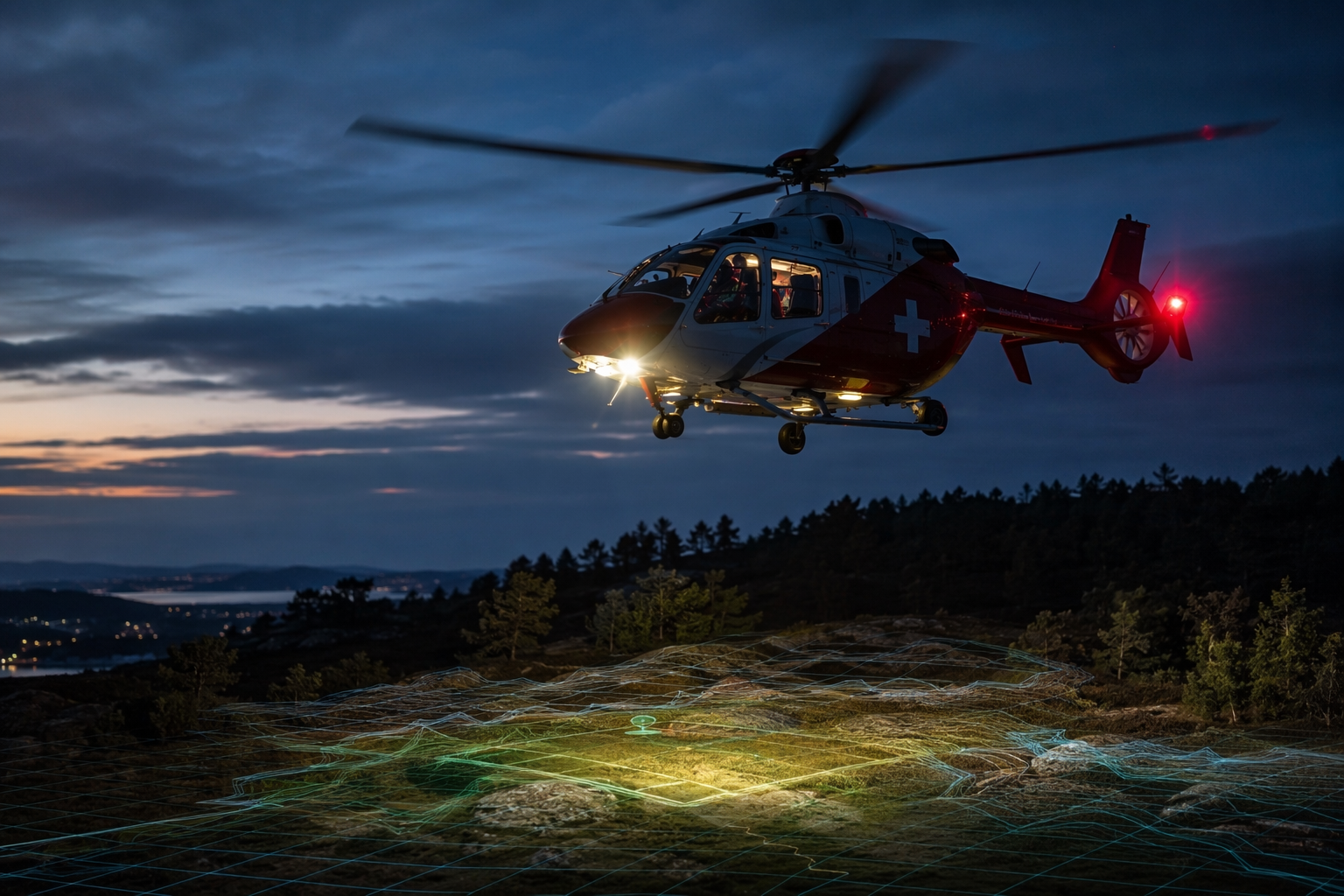
That is the right frame for the Hsueh et al. scoping review, which mapped 21 AI studies in Helicopter Emergency Medical Services and found that more than a third were published in 2021 or later, with non-clinical AI studies growing faster than clinical ones (OR 1.3 per year). Landing zone detection sits in that non-clinical lane, and that matters because it is one of the clearest places where AI can be judged by an operational outcome rather than by a diagnostic label [1].
The question can drift in other directions too easily. It can slide toward autonomous landing, dispatch optimization, or generic emergency medicine AI. The useful question here is narrower: can AI help crews identify a safe landing zone fast enough, and with enough confidence, to reduce the burden on the people who still have to make the final call?
From suitability maps to live sensing
The older baseline is Doherty et al.'s 2013 comparison of expert judgment and machine suitability models for emergency helicopter landing areas in Yosemite National Park. It was not a real-time cockpit assistant, but it established the logic that still underpins the field: encode terrain, obstacles, and access constraints, then rank places that look landable before the aircraft gets there [2].
That GIS approach is useful, but it is still a suitability model. It can support planning and preselection, yet it cannot see a wire line that appears in the dusk, a tree canopy that hides a slope, or a scene that has changed since the map was built.
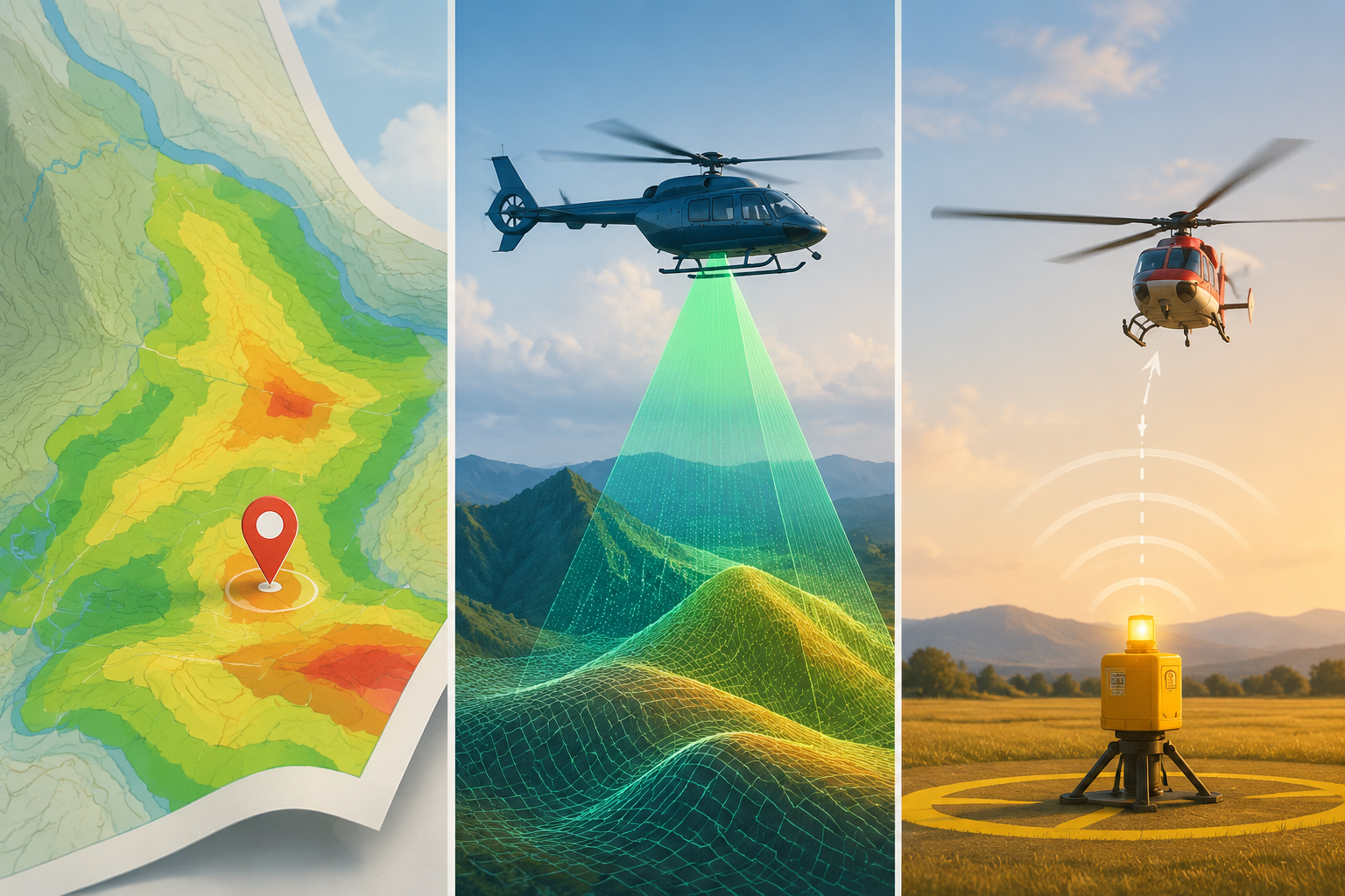
Massoud and Fahmy pushed closer to operation in 2023 with real-time safe landing zone identification based on airborne LiDAR. That matters because the system is not just scoring a static map; it is using airborne point-cloud data to identify a safe site in the moment, which is much closer to the way a crew actually works when the landing question arrives late and the scene is already unfolding [3].
Herath et al. carried the idea further in 2025 with an AI-driven landing zone detection module for VTOL navigation, putting modern perception and navigation into the same frame. It is still a prototype paper, but it shows that the problem has moved out of the 'can machine learning even describe the site?' stage and into 'can it support the aircraft as it approaches the site?' [4].
What has escaped the journal page
The most concrete sign that landing-zone AI has escaped the lab is LZ Guardian AI, a 2026 Tech Briefs contest entry describing a ground-deployed beacon that can verify a 100 x 100 ft landing zone in seconds and is pitched at less than $1,000 per kit versus $23,000 to $30,000-plus for cockpit-based systems. That price contrast is tempting, especially for smaller departments that would never buy an expensive avionics package, but it is still a projection attached to a contest entry with patent pending, not evidence of a deployed clinical workflow [5].
Leonardo's collaboration with Daedalean adds another sign of translational momentum from the rotorcraft side: flight-tested visual awareness combining cameras, object detection, wire detection, and GPS-denied navigation for remote landing site finding. It is useful proof that industry is taking the problem seriously, but it is not the same thing as a widely adopted HEMS landing-zone product or a system cleared for routine clinical use [6].
That gap matters because an operational crew does not need a demo that is right most of the time in clean weather. It needs a system whose failure modes are understood when visibility drops, terrain is cluttered, and the site is unfamiliar. On that standard, the evidence is promising but still thin: prototypes, a small literature, and no broadly adopted system that has crossed into routine clinical use.
What the evidence supports
The practical value is not autonomy. It is uncertainty reduction: a faster way to reject bad sites and focus attention on the few that remain. That is useful in HEMS because the hard choice is often not whether a helicopter can land somewhere, but whether the crew can justify landing there now.
Airborne LiDAR, VTOL perception modules, and ground-deployed beacons each solve a different part of the problem. The airborne systems help the aircraft assess what it is approaching; the ground beacon helps a scene crew mark or verify a site; the older GIS approach helps planning. Those are not interchangeable, and the distinction matters when an article starts implying that any one of them means the landing problem has been solved.
AI has moved far enough to look operationally relevant, but not far enough to justify casual adoption. For HEMS teams, the deciding questions are still evidence quality, visibility limits, workflow fit, and regulatory status. Until a system proves itself outside the prototype lane, the right posture is careful interest rather than faith.
References
- Applications of Artificial Intelligence in Helicopter Emergency Medical Services: A Scoping Review, Air Medical Journal, 2024, https://www.airmedicaljournal.com/article/S1067-991X(23)00263-8/abstract
- Expert versus Machine: A Comparison of Two Suitability Models for Emergency Helicopter Landing Areas in Yosemite National Park, The Professional Geographer, 2013, https://www.tandfonline.com/doi/abs/10.1080/00330124.2012.697857
- Real-Time Safe Landing Zone Identification Based on Airborne LiDAR, Sensors, 2023, https://www.mdpi.com/1424-8220/23/7/3491
- AI-Driven Landing Zone Detection Module for Vertical Take-Off and Landing Navigation, IEEE Transactions on Aerospace and Electronic Systems, 2025, https://ui.adsabs.harvard.edu/abs/2025ITASE..2214577H/abstract
- LZ Guardian AI, Tech Briefs Contest Entry, 2026, https://contest.techbriefs.com/2026/entries/aerospace-and-defense/14261-0629-175839-lz-guardian-ai-ground-deployed-safety-for-helicopter-landing-zones
- AI / Daedalean collaboration, Leonardo Helicopters, https://helicopters.leonardo.com/en/focus-detail/-/detail/ai
Comments
Join the discussion with an anonymous comment.