
For a hiker clipping a lead onto a dog at a trailhead in bear country in 2026, the useful question is not whether AI can recognize a bear somewhere. It can. The useful question is whether an AI system can change a decision before the risky moment arrives: choose a different route, delay a trip, alert a ranger, trigger a deterrent, or find someone after the plan has already failed.
On that narrower question, the evidence is less cinematic than the product category suggests. There is no validated, integrated, real-time AI warning system for recreational hikers with dogs in bear country in the evidence reviewed here. What does exist is three partial technologies: fixed-location bear detection, predictive encounter-risk mapping, and AI-assisted drone search and rescue. Each is real. Each has field or research support. None should be mistaken for a dog-aware wearable trail alarm.
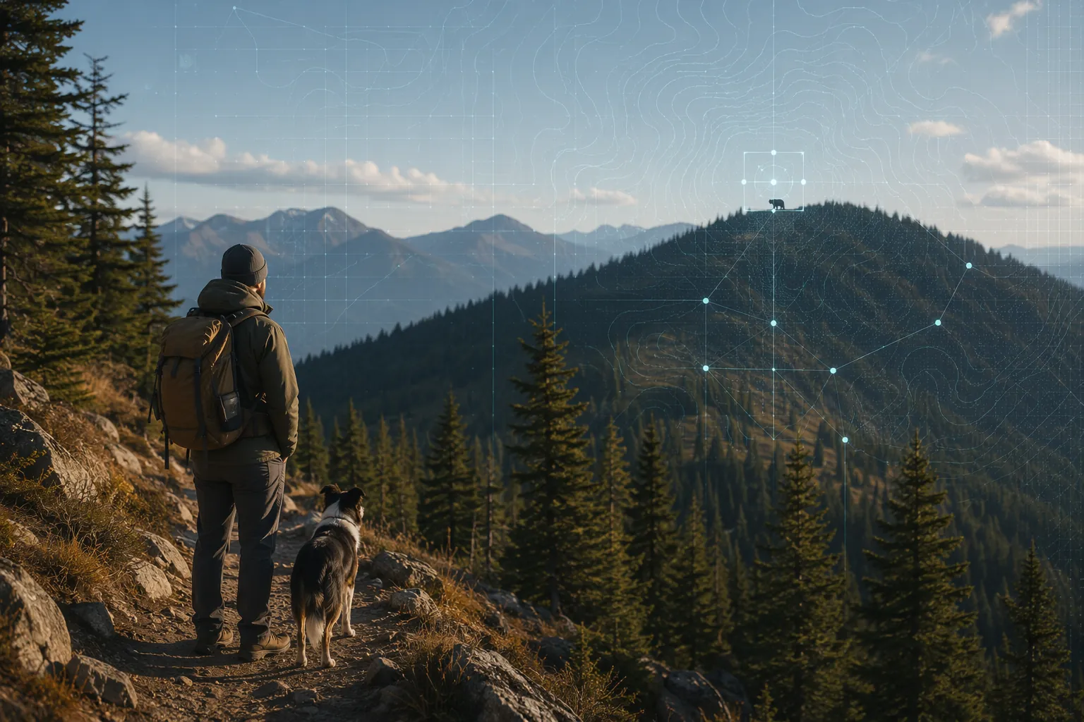
The detector works best when the trail does not move
The strongest bear-detection examples are not wandering with a hiker. They are watching a place: a settlement edge, a camera-trap corridor, a community boundary, or a polar research outpost. That distinction matters because fixed systems can control the camera angle, power source, communications link, and response plan. A person on a trail has none of those guarantees.
One technically elegant example comes from Chen et al., a 2025 preprint describing a YOLOv5-based intelligent bear-prevention system for the Tibetan Plateau. The system used a low-power K210 board and reported 91.4% mAP, 93.6% recall, 94.7% F1 score, and a 3.79% false-positive rate. It was designed as an IoT deterrent system for settlement protection, not as a recreational hiking device carried through changing terrain and weak communications coverage.[1]
Those numbers are worth attention because low-power edge detection is exactly the kind of engineering that could eventually matter outdoors. A system that can identify a bear locally, without sending every image to a distant server, is more plausible for remote safety than a cloud-only system. But the setting still decides the usefulness. A settlement-protection camera can stare at a known approach route. A backpack-mounted or dog-collar-mounted detector would have to handle motion blur, changing light, occlusion, vegetation, weather, animal distance, battery limits, and a much harder question: what does it tell the hiker to do next?
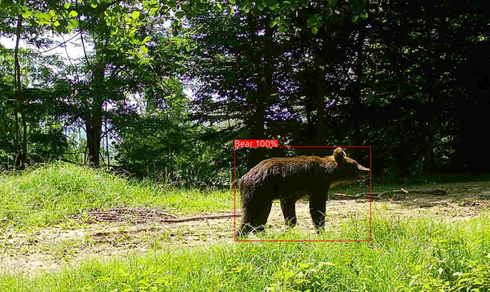
The Romanian Carpathian work is closer to a lived field deployment. In a project described by Endangered Landscapes, a real-time alert system for bears and wild boars used MegaDetector and an adapted DeepFaune model trained on 26,000 labeled photos. At two locations over three months, the system was reported to have an approximately 100% correct identification rate.[2] That is the sort of result that should make safety people lean forward, then immediately ask what the denominator, species mix, locations, seasons, and failure modes looked like.
The Q42/Carpathia pilot shows the same operational shape. It used 14 camera-trap units, processed about 250 images per day, and connected AI classification to an automated deterrent response.[3] Again, the important thing is not just classification. It is the chain from detection to consequence: image captured, animal classified, alert or deterrent triggered, human conflict potentially avoided. That chain is meaningful around villages, farms, and conservation corridors. It is not yet the same as a mobile safety system for a person and dog moving through North American bear habitat.
Polar bear detection pushes the point even further. Polar Bears International describes Bear-dar as a radar-based early detection system deployed in Eureka in 2025.[4] Radar may avoid some limitations of optical cameras, especially darkness and visibility problems, but it also belongs to a very specific geography and risk profile. A polar bear warning system at an Arctic site cannot be casually transferred to a summer hiker with a dog in grizzly or black bear country.
| Technology | Where the evidence places it | What it can reasonably support | What it does not yet support |
|---|---|---|---|
| Computer vision or radar detection | Fixed sites, camera traps, settlement edges, research or community-protection deployments | Local monitoring, alerts, deterrents, wildlife-conflict mitigation | Validated real-time warning for moving recreational hikers and dogs |
| Predictive risk mapping | Regional models using past appearances, landscape variables, weather, and human-settlement features | Pre-trip planning and route-level risk awareness | Moment-by-moment bear proximity detection on trail |
| AI-assisted drone search and rescue | Emergency response after people are missing | Faster search support in some rescue conditions | Bear encounter prevention before the incident |
Risk maps are the most plausible help for hikers right now
If the goal is to reduce risk before anyone is standing too close to a bear, predictive mapping currently has the cleanest path to recreational use. It does not have to see the animal in real time. It only has to help a person make a better pre-trip decision: choose a different trail, avoid a high-risk zone during a high-risk period, or understand why a familiar route may not be the safer route this week.
Fukazawa and colleagues at Sophia University built an AI bear encounter prediction model using 1,736 bear-appearance cases and 2,078 non-appearance cases from Akita Prefecture, Japan. The model reported 63.5% precision and 63.6% recall at 1 km² grid resolution, and a publicly available Bear Encounter AI Prediction Map was released for 19 Japanese regions in November 2025.[5]
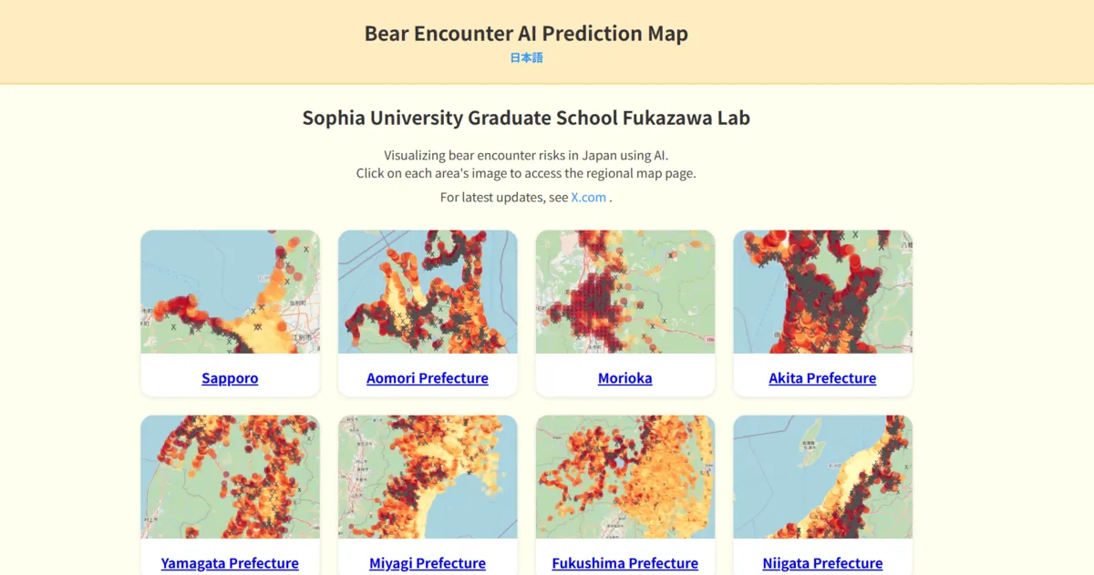
A 63% range performance figure will not satisfy anyone hoping for a magic shield. It should not. But for planning, the threshold is different from a real-time alarm. A map that is imperfect but meaningfully better than guessing can still change behavior before exposure. In wilderness medicine terms, this is closer to injury prevention than rescue: move the decision upstream, when the cost of changing plans is still low.
The predictors are also practical enough to be useful: previous-year bear locations, bamboo groves, wetlands, rain and thunderstorms, and aging-population patterns associated with abandoned farmland.[5] That last variable is a reminder that bear risk is not just wilderness in the postcard sense. Human land use, food availability, settlement change, and weather can all shift where encounters become more likely.
There is a limitation that matters for an actual hiker opening a phone before leaving home: the Sophia model uses actual weather data rather than forecast data.[5] That narrows its real-time planning utility. If tomorrow's thunderstorms would change the risk picture, a model that depends on observed weather is not the same as a forecast-ready decision tool. It may still be useful for regional awareness, seasonal planning, and public-risk communication, but the user interface should not imply precision it does not have.
The geography is just as important as the algorithm. The Sophia work concerns bear appearances in Japan, including Asiatic black bear contexts. A risk surface trained in Akita Prefecture should not be lifted wholesale into Montana, Alberta, Wyoming, British Columbia, or Appalachia. North American grizzly and black bear hiking contexts differ in species, terrain, reporting systems, food sources, visitor behavior, and management practices. Transfer might be possible someday, but it would have to be tested rather than assumed.
Sophia's adjacent mountaineering accident work is relevant for the broader pattern, not for bear warning itself. Sato and Fukazawa used Japanese BERT to predict mountaineering accident type from 2,596 cases and reported about 57% accuracy.[6] That result does not prove bear-risk prediction for hikers with dogs. It does show that outdoor safety problems are being translated into structured prediction tasks, where the output can support prevention and preparedness rather than simply describe past incidents.
Drone rescue is real, but it starts after prevention has failed
The cleanest operational outcome in the current evidence is not bear prevention at all. In June 2026, an AI-powered drone with thermal imaging located two lost hikers in Kosciuszko National Park in New South Wales within hours. The report described it as a first-of-its-kind rescue, with AI distinguishing humans from animals in real time.[7]
That matters. Search teams lose time deciding where to look, moving people through difficult ground, and separating possible human signatures from everything else warm enough to confuse a sensor. A drone that can help sort human from animal heat signatures can change the tempo of a rescue. The person waiting on the ground does not care whether the system is fashionable; they care whether someone gets eyes on them before hypothermia, injury, exposure, or darkness changes the outcome.
Still, a rescue drone is downstream. It does not tell a hiker with a dog that a bear is beyond the next bend. It does not estimate whether a trailhead is a poor choice this afternoon. It does not replace route planning, group communication, or ranger advisories. The NSW case demonstrates promise in emergency response, especially where thermal imaging and AI classification can shorten search time, but one first-of-its-kind report should not be stretched into a general evidence base for bear-country prevention.
This is where AI emergency-response work connects naturally with other time-critical settings. The same basic safety question appears in AI-assisted triage, disaster forecasting, and early warning: does the system move a scarce resource to the right place soon enough to matter? That is also the useful bridge to related ClinicalMind coverage on AI-assisted triage in mass shooting response, AI-driven hurricane cone narrowing, and earthquake early warning linked to emergency health response. In each case, the technical result only becomes safety-relevant when it changes dispatch, avoidance, treatment, or timing.
The dog-specific gap is not a footnote
Dogs change bear-country risk decisions. They can add noise, movement, scent, and unpredictability; they can also be the reason a hiker chooses one route or pace over another. But the AI evidence reviewed here does not identify a dog-specific wildlife proximity detector or a bear-warning system validated for hikers with dogs.
Canine health-monitoring wearables such as SmartSense Pet and PetPace exist, but their relevance is limited to health and activity monitoring in this context. A collar that tracks vitals is not a bear detector. A pet wearable is not a wildlife-conflict model. Treating those as parts of an integrated bear-safety system would be category drift, not evidence synthesis.
For a wilderness medicine audience, that distinction is not pedantic. If a tool is marketed or interpreted as protective, someone may rely on it at the moment when ordinary caution should be doing the work. The absence of dog-specific validation means the answer to the title question remains narrow: AI may support route planning and rescue response around bear country, but it has not yet shown evidence-supported maturity as a real-time hiker-and-dog safety system.
The wider human-wildlife evidence is encouraging, with limits
The broader literature does not argue for dismissing AI. Ojija et al.'s 2025 systematic review of 105 studies from 1990 to 2025 found AI applications in human-wildlife conflict mitigation improved monitoring in 65% of applications, predictive accuracy in 47%, and community engagement in 39%; detection precision reached 96.2% in some deployments.[8] That is a serious signal that AI is already useful in parts of wildlife conflict work.
It is also a broad signal. Human-wildlife conflict includes many species, landscapes, institutions, and response goals. Monitoring improvement is not the same as fewer injuries to hikers. Predictive accuracy in one ecological or community setting is not the same as a trail-level warning for a moving person with a dog. A systematic review can justify interest and investment; it cannot erase the need for validation in the actual population and setting.
That is the clinical-applications standard applied outdoors: population, setting, outcome, limitation. Who is the user? A village resident, ranger, conservation team, solo hiker, family group, dog handler, or search-and-rescue coordinator? Where does the system run? A fixed camera trap, public web map, drone platform, phone app, collar, or trailhead kiosk? What outcome changes? A deterrent fires, a trip is rerouted, a rescue grid is narrowed, or a person simply receives another ambiguous alert.
What evidence-supported use looks like in 2026
For hikers, the most defensible AI use today is pre-trip risk awareness where a regional map exists and the user understands its boundaries. A map like the Sophia University Bear Encounter AI Prediction Map can support planning in the regions for which it was built, provided users do not mistake grid-level probability for a guarantee about a particular trail segment.[5]
For land managers and communities, fixed detection systems may already be operationally useful where bears approach predictable edges and where power, cameras, networks, deterrents, and human response protocols can be maintained. The Romanian and Q42/Carpathia examples belong here: field-tested wildlife monitoring or deterrence deployments, not consumer hiking safety systems.[2][3]
For rescue teams, AI-assisted drones are promising when the problem is no longer avoidance but location. The NSW rescue shows how real-time classification of humans versus animals could reduce search time in the right terrain and operating conditions.[7] The evidence should now move from striking case reports toward repeatable measures: time to locate, false detections, missed detections, terrain constraints, weather limits, staffing demands, and outcomes compared with existing search methods.
For consumer wearables aimed at hikers with dogs, the evidence-supported answer is still no. The necessary pieces are visible in adjacent domains, but they have not been assembled and validated for the use case. A credible system would need to show performance in the intended bear species and geography, under trail motion and weather, with limited connectivity, acceptable battery life, low false-alarm burden, and instructions specific enough that a hiker can act without freezing, overreacting, or ignoring the next alert.
That is not pessimism. It is the difference between a technology that detects something and a safety system that protects someone. In 2026, AI is already useful around the edges of bear-country safety: before a trip, where risk maps can influence route choice; around communities, where fixed detectors can support alerts or deterrents; and after someone is lost, where drones may help search teams find people faster. The missing product is the one hikers with dogs may imagine first: an integrated, real-time, validated bear-warning system that travels with them on the trail.
References
- Intelligent Bear Prevention System Based on YOLOv5 and IoT Technology, arXiv, 2025.
- AI for wildlife monitoring: A real-time alert system for bears and wild boars in Romania's Carpathian Mountains, Endangered Landscapes, 2024.
- AI Bear Repeller, Q42 Engineering, 2023.
- Bear-dar, Polar Bears International, 2025.
- AI model predicts bear encounters before they happen, The Mainichi, 2025.
- Mountaineering accident type prediction using Japanese BERT, International Journal of Data Science and Analytics, 2025.
- In First-of-Its-Kind Rescue, AI Drone Finds Lost Hikers in Australian Park, ExplorersWeb, June 2026.
- Artificial intelligence for human-wildlife conflict mitigation: A systematic review, PMC, 2025.
Comments
Join the discussion with an anonymous comment.