
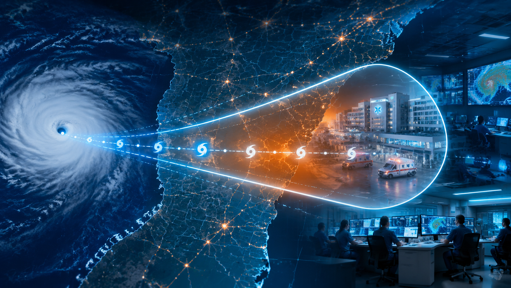
A hospital does not wait for perfect certainty before a hurricane. It waits until the uncertainty is small enough, the clock is short enough, and the consequences of waiting are worse than the consequences of moving. That is where AI in tropical storm path prediction for emergency response has become more than a forecasting story. A narrower cone can change whether a hospital evacuates ventilated patients in daylight, pre-positions a ride-out team before bridges close, moves pharmacy inventory above flood level, or keeps fragile patients in place because the risk area has shifted away.
The cone of uncertainty is not a map of storm size. It is a track-error product: a way of showing where the center of a tropical cyclone is likely to travel based on historical forecast error. When that cone narrows, the practical question is not whether the graphic looks cleaner. It is which hospitals, counties, transfer routes, dialysis centers, fuel depots, and ambulance staging areas remain inside the decision zone.
The Forecast Signal Has Improved, But the Baselines Matter
The strongest case for paying attention comes from the 2025 Atlantic hurricane season. Google DeepMind reported that its AI tropical cyclone model achieved the highest track and intensity skill scores of any model during the season, with National Hurricane Center post-season analysis showing its 5-day track prediction averaged 140 km closer to the true storm location than the ECMWF ensemble, a leading physics-based ensemble model.[1][2]
That comparison is specific: DeepMind versus ECMWF ENS on 5-day track error. It should not be blended into a generic claim that every AI model is 140 km better, or that the same gain applies to storm intensity. In hospital terms, though, a 140 km track improvement at five days is not cosmetic. It can change which coastal facilities begin transfer calls, which inland hospitals prepare to receive patients, and which supply routes are still credible.
NOAA’s 2026 deployment of AI-driven global weather models adds a different kind of operational evidence. Its AIGFS uses 99.7% less computing resources than the traditional Global Forecast System while matching or exceeding its skill, and NOAA reported that its AI ensemble extended skillful forecast lead time by 18–24 hours compared with traditional physics-based ensembles.[3]
Speed matters because late precision can still be operationally useless. A forecast that arrives after the last safe ambulance window, after staff have scattered to protect their own families, or after suppliers have stopped dispatching trucks may be impressive but not actionable. Eighteen additional hours can be the difference between a staged ICU transfer and a half-finished evacuation with road conditions degrading.
NOAA’s hybrid ensemble is also a useful warning against treating AI as a stand-alone replacement. The HGEFS combines 31 physics-based and 31 AI-based members and consistently outperformed either approach alone across most verification metrics.[3] An ensemble model is simply a set of model runs used to estimate a range of plausible futures. For emergency response, the ensemble spread is often as important as the single best track, because it shows how much confidence a command center should place in a decision.
Other AI systems point in the same direction, again with their own baselines. The Aurora foundation model reduced Atlantic tropical cyclone track errors by approximately 20–25% versus seven major global operational forecast centers in a Nature Communications benchmark study.[4] Colorado State University’s CIRA researchers independently evaluated DeepMind’s model and found “comparable or greater skill than the best operational models for track and intensity,” including strength on rapid intensification cases at 2–3 day lead times.[5]
Rapid intensification means a storm strengthens quickly over a short period. It is one of the forecast problems that matters most to hospitals because evacuation decisions become harder, riskier, and more politically expensive when a storm that looked manageable becomes dangerous inside the last two or three days. The encouraging finding is that at least some AI models are showing skill in that window. The caveat is just as important: NOAA has said AIGFS v1.0 still underperforms on intensity forecasting, especially rapid intensification.[3]
What a Narrower Cone Changes Inside a Hospital Command Center
The first operational gain is geographic. A smaller track error reduces the number of facilities forced into the same urgent posture. The National Weather Service has pointed to Hurricane Beryl in 2024, when the NHC’s forecast error 72 hours before landfall was 67 miles.[2] In a dense healthcare region, 67 miles can separate a county that should activate evacuation planning from one that should preserve receiving capacity.
That distinction matters because healthcare evacuation is not a simple transportation problem. It is a clinical risk tradeoff. Moving a ventilated ICU patient, a neonatal patient, or a medically fragile long-term care resident can itself cause harm. Over-evacuation consumes ambulances, beds, nurses, respiratory therapists, oxygen, medications, and family communication capacity. Under-evacuation leaves the same patients exposed to floodwater, power failure, heat, road isolation, and delayed rescue.
A better forecast does not make that tradeoff disappear. It gives the command center a better boundary for deciding who must move, who should prepare to move, and who should remain available to receive patients from somewhere else.
| Forecast Change | Operational Question | Hospital Action It Can Trigger |
|---|---|---|
| Track error decreases at 3–5 days | Which facilities and counties are still plausibly in the impact zone? | Open evacuation planning, notify transfer partners, review census by acuity, protect critical infrastructure |
| Skillful lead time extends by 18–24 hours | Can the system act before transport, staffing, and road conditions deteriorate? | Stage ICU transfers, pre-position ride-out teams, secure fuel, move pharmacy and sterile supplies |
| Ensemble spread tightens | Is uncertainty low enough to cross a predefined threshold? | Escalate from monitoring to partial activation or full incident command |
| Rapid intensification risk appears at 2–3 days | Does the current shelter-in-place plan still fit the storm’s likely strength? | Reassess evacuation timing, generator fuel assumptions, surge staffing, and receiving capacity |
| Flood depth forecast becomes location-specific | Which buildings, entrances, loading docks, and utility rooms are exposed? | Deploy flood barriers, relocate generators or pumps where possible, reroute deliveries and ambulances |
The second gain is timing. Hospitals often have plans that look reasonable until the clock starts. A full evacuation requires physician orders, patient prioritization, transport matching, receiving-bed confirmation, medication reconciliation, device and oxygen planning, family notification, documentation transfer, security, and route monitoring. The work is sequential in places where people wish it were parallel.
An additional 18–24 hours of skillful lead time does not mean a hospital has 18–24 hours to admire the forecast. It means the first decision can move earlier: from “watch and wait” to “call receiving hospitals,” from “check supplies” to “move them,” from “consider ride-out staffing” to “lock the schedule and sleeping space.” Those verbs are where forecast skill becomes clinical preparedness.
Evacuation Decisions Need Thresholds Before the Storm Exists
The worst time to decide an evacuation threshold is during a briefing where every department is already defending its own risk. AI forecasts are most useful when they feed a protocol that was written before names appear on the storm list.
A workable threshold is not just “inside the cone.” It ties forecast products to local vulnerabilities. A coastal hospital with basement electrical systems, a low ambulance bay, and a history of access-road flooding should not use the same trigger as a hardened inland facility whose main problem is receiving surge. The relevant threshold may combine expected storm track, ensemble confidence, surge or flood risk, generator vulnerability, time to complete transfer, and the availability of receiving beds.
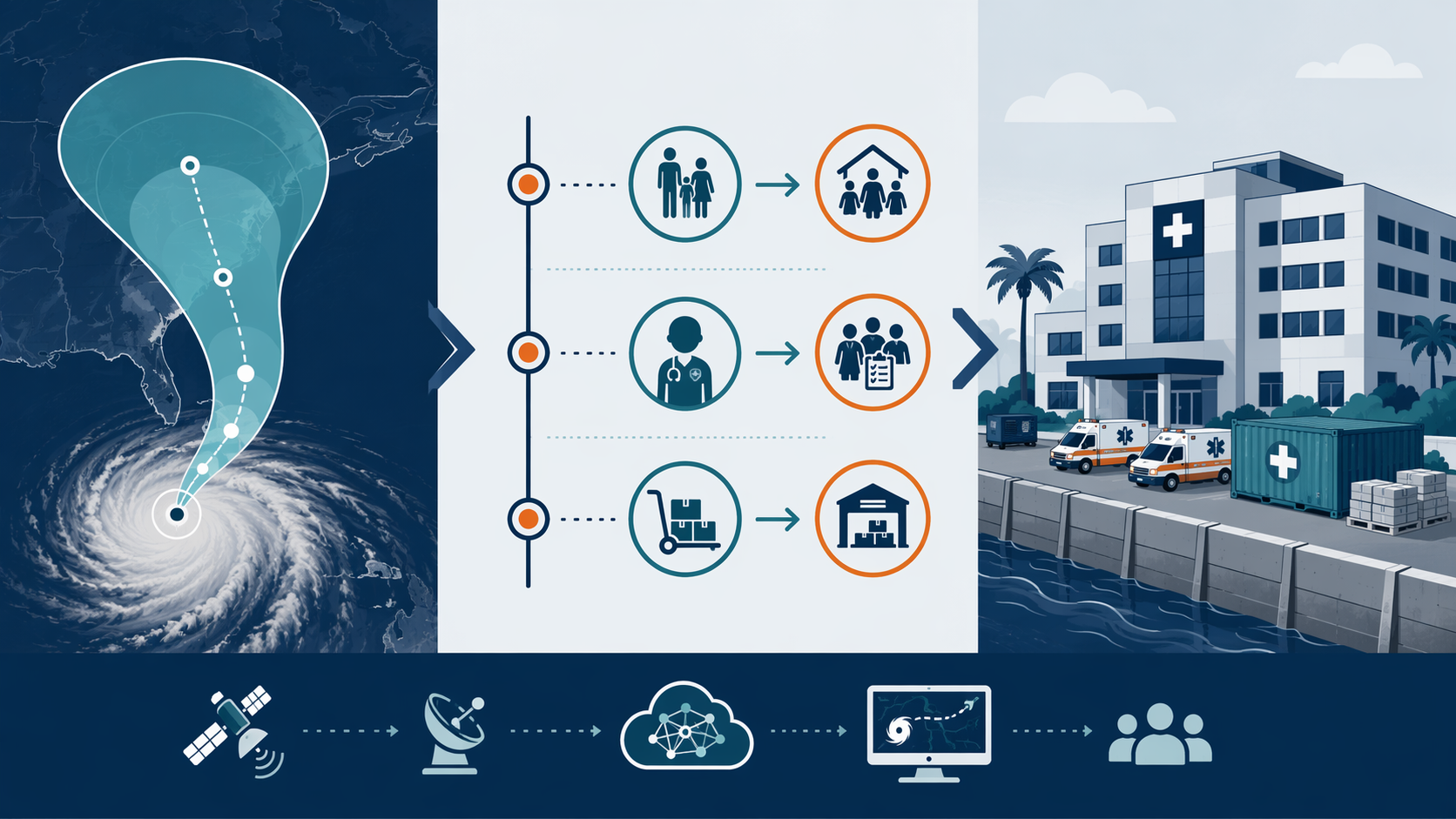
The forecast-to-action sequence can be simple on paper:
- At the monitoring threshold, incident command reviews census, staffing, fuel, oxygen, blood products, pharmacy inventory, generator status, and vendor contacts.
- At the planning threshold, transfer coordinators contact receiving facilities, ambulance partners, dialysis providers, and public health agencies.
- At the activation threshold, the hospital begins partial evacuation, staff pre-deployment, supply relocation, or facility protection work.
- At the lock-in threshold, leaders stop assuming that outside transport, routine deliveries, or normal shift changes will remain available.
The hard part is not naming the thresholds. It is making them binding enough that leaders can act before the forecast becomes emotionally convincing to everyone. If a hospital waits until the cone is narrow enough to make the decision obvious, the transport window may already be closing.
Staffing and Surge Planning Are Part of the Same Forecast Window
Storm staffing is often discussed as if the hospital can simply call more people. In practice, staff are also parents, caregivers, evacuees, dialysis patients, pet owners, and residents of the same threatened counties. A narrower cone can reduce unnecessary staff lockdowns outside the impact zone, but it can also justify earlier ride-out activation for facilities that remain in the path.
Emergency departments need this timing because their surge is not limited to storm injuries. They may see dialysis interruptions, oxygen-dependent patients who lost power, medication gaps, heat illness, carbon monoxide exposure after generator misuse, behavioral health crises, and people who arrive because every other door has closed. The ED may also lose throughput when inpatient units are full, transport is unavailable, or discharge destinations are unsafe.
The AI-enabled forecast does its best work here when it gives leaders enough confidence to make unpopular staffing decisions early. That may mean holding a night shift past normal release, asking a relief team to arrive before landfall, staging clinicians at a sister facility, or canceling elective activity before the system is saturated. The decision is less elegant than the model, but it is where the patient safety margin lives.
For readers interested in the broader emergency medicine pattern, the same translation problem appears in AI in Emergency Medicine: Triage, Sepsis Prediction, and Stroke Decision Support: a prediction only helps when it reaches the person who can act, early enough to change care.
Supplies, Power, and Flood Protection Turn Lead Time Into Capacity
Supply staging is one of the least glamorous uses of a better hurricane forecast, and one of the most valuable. Pharmacy directors need time to secure refrigerated medications, controlled substances, emergency carts, IV fluids, and backup dispensing workflows. Facilities teams need time to test generators, confirm fuel, protect oxygen systems, inspect roof drains, stage pumps, and decide which doors, docks, and utility spaces are likely to fail first.
This is where track forecasting connects to flood forecasting. Georgia Tech researchers have described physics-informed AI methods that can forecast building-level flood depths 3–5 days before landfall with greater than 90% accuracy.[6] For a hospital, that level of spatial detail can affect whether flood barriers go to the ambulance entrance, the loading dock, the emergency generator area, or a utility corridor.
A 3–5 day building-level flood forecast does not guarantee that a hospital has barriers, labor, pumps, or authority to alter traffic flow. It does, however, make vague concern harder to ignore. If a loading dock is likely to flood before the last supply delivery, the decision is no longer “watch the storm.” It is “move the delivery window or move the receiving point.”
The same logic applies to fuel and oxygen. Better path prediction can identify which facilities are likely to be isolated, but it cannot create tanker availability, repair crews, cylinder stock, or safe road access after landfall. Those contracts and mutual aid agreements have to exist before the forecast improves.
Official Advisories Still Carry the Decision Authority
AI storm models are not the official hurricane warning system. The National Hurricane Center still issues the official advisory, and its forecasters synthesize model guidance, observations, uncertainty, and meteorological judgment. Wallace Hogsett, the NHC Science Operations Officer, has described AI models as “a new hammer in the toolbox,” not a replacement for physics-based models or human forecasters.[2]
That distinction matters in healthcare governance. A hospital emergency manager can use AI model performance to understand confidence and timing, but activation policies should specify which official products trigger which actions. Otherwise, a command center can end up debating model preference instead of executing a plan.
A practical policy can still incorporate AI-era improvements. It can require review of NHC advisories, ensemble spread, local emergency management guidance, flood products, and health system vulnerability maps at defined intervals. It can also document when an earlier preparatory action is allowed because multiple model sources show tightening risk, even before a mandatory evacuation order is issued.
The Prediction-to-Action Gap Is the Real Limiting Factor
The evidence supports a careful claim: AI-based storm models are making tropical cyclone track forecasts more accurate and, in some systems, extending useful lead time. The evidence does not support a shortcut claim that AI forecasts alone reduce casualties. Yale Climate Connections and RAND have both emphasized the same uncomfortable boundary: disaster prediction only becomes protection when communities have infrastructure, evacuation capacity, funding, and response protocols able to act on the warning.[7][8]
Hospitals feel that boundary immediately. A forecast can identify a better evacuation window, but it cannot open receiving beds. It can narrow the threatened geography, but it cannot supply ambulance crews. It can show that a facility is likely to lose road access, but it cannot harden the electrical room, refill the generator tank, or make a vendor drive into deteriorating conditions.
The institutions most likely to benefit from AI storm path prediction are not necessarily the ones with the most sophisticated dashboards. They are the ones that already know what they will do when the forecast crosses a threshold. Their call-down trees work. Their transfer agreements are current. Their supply caches are real, not just spreadsheet lines. Their facilities team knows which barrier goes where. Their incident command structure can make a decision before all anxiety has resolved.
This is the same lesson that applies across AI disaster early warning systems. In AI Links Earthquake Early Warning and Emergency Health Response, the warning interval is much shorter, but the operational test is familiar: whether a prediction reaches a prepared system quickly enough to change what people do.
How Health Systems Should Use AI-Era Hurricane Forecasts
The right response is not to build a hospital plan around a single AI model. It is to update hurricane preparedness so better forecasts can actually change action. That means treating AI-enhanced guidance as earlier, faster, and sometimes more accurate input into a disciplined emergency management process.
- Map forecast thresholds to actions before hurricane season, including monitoring, planning, activation, and lock-in points.
- Separate evacuation triggers by patient acuity, facility vulnerability, transfer time, and receiving capacity rather than using one hospital-wide rule.
- Use ensemble confidence and official advisories together, while preserving the NHC advisory as the authoritative public warning product.
- Rehearse the 18–24 hour lead-time gain as an operational interval: which calls, transfers, supply moves, and staffing changes happen inside that window.
- Tie track forecasts to local flood, power, oxygen, fuel, and access-road vulnerabilities so the response is facility-specific.
- Audit contracts and mutual aid agreements for what they can deliver before landfall, not what they promise in normal conditions.
A hospital that does this well will not treat every narrower cone as an evacuation order. It will use the narrowing to make earlier, more proportionate decisions: move the patients who cannot safely remain, protect the departments most likely to fail, staff the units that will absorb surge, and avoid consuming regional capacity when the risk has moved elsewhere.
AI-based tropical storm path prediction gives healthcare systems a better window before landfall. Hospitals turn that window into safer evacuations, staffing, and resource staging only when the response machinery is already built, funded, and rehearsed.
References
- How we’re supporting better tropical cyclone prediction with AI, Google DeepMind
- AI Hurricane Forecasting, National Weather Service
- NOAA deploys new generation of AI-driven global weather models, NOAA
- Aurora: A foundation model of the atmosphere, Nature Communications
- AI Hurricane Forecasting: A New Hammer in the Toolbox for Saving Lives and Property, CIRA, Colorado State University
- How AI-Powered Flood Forecasts Could Transform Hurricane Resilience, Georgia Tech
- AI can predict disaster, but it can’t save you, Yale Climate Connections, July 2026
- How AI Is Changing Our Approach to Disasters, RAND, August 2025
Comments
Join the discussion with an anonymous comment.