
The useful question for AI tools for wilderness rescue and bear attack evidence is not whether a drone can take a striking thermal image. It is whether that image changes what happens in the next hour: where a search team walks, where a pilot flies, whether a medical team prepares for hypothermia or heat illness, and whether anyone can trust the inference before a rescuer reaches the patient.
That distinction matters because thermal drones are already part of search-and-rescue work, while AI-assisted medical triage from drone imagery remains a research-stage extension. Finding a warm human-shaped signal in brush is one task. Inferring consciousness, forehead temperature, or possible death from thermal and infrared imagery is a different clinical claim, and it carries different consequences.
From locating a person to reading their condition
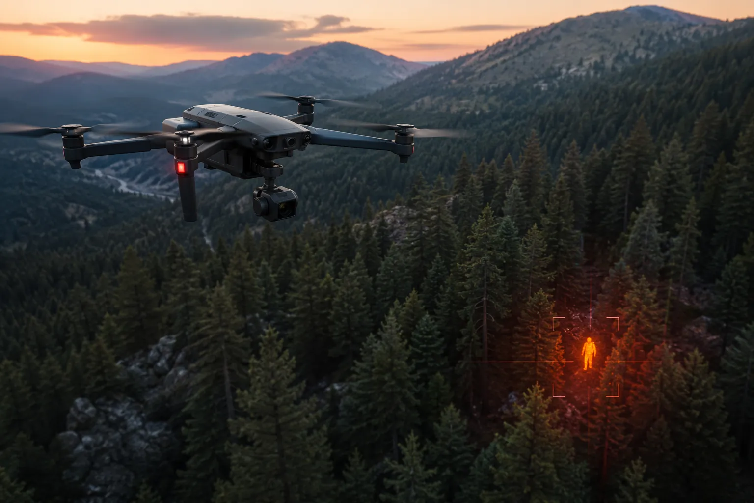
The most clinically interesting work in this area is the Kennesaw State University system presented at the AIAA Aviation Forum 2026. The system uses deep learning on thermal and infrared drone imagery to detect human presence, segment body parts, extract temperature from the forehead region, and estimate whether the person appears conscious. It is also described as identifying abnormal body temperature states, including heat stress, hypothermia, and death.[1]
Those functions sit unusually close to pre-hospital triage. A search team does not only need to know that someone is somewhere in a ravine. It needs to know whether to send a hasty team with warming gear, whether to stage a technical evacuation, whether to alert a helicopter crew, or whether the subject may be moving and still able to respond. A model that separates a forehead from the rest of the body is not doing a cosmetic computer-vision trick. It is trying to isolate a region that may be more clinically informative than a boot, backpack, dog, rock, or sun-warmed stump.
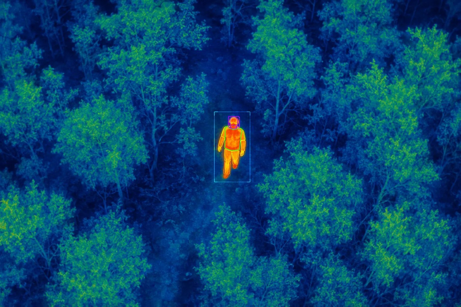
Still, the jump from segmented thermal image to clinical state is the narrow place where this technology has to be judged carefully. Consciousness is not a pixel label. Hypothermia is not simply looking cold in a frame. Heat stress, death, and altered mental status all depend on context, exposure, time, perfusion, movement, environment, and measurement error. A forehead temperature extracted from a drone image may become operationally useful, but it is not the same thing as a core temperature, a field exam, or a monitor reading.
The Kennesaw State work is therefore best understood as technical feasibility, not deployed clinical decision support. It shows that one integrated pipeline can move beyond human detection toward body-part segmentation and preliminary status estimation. It does not yet establish how well the system performs in real wilderness operations, under canopy, across seasons, with wet clothing, steep terrain, partial body exposure, variable drone altitude, or degraded communications. The available reporting does not characterize false positive rates, terrain effects on thermal accuracy, or training data depth across the range of environments that rescue teams actually see.[1]
Why the first hour is a search problem and a medical problem
In a city ambulance call, the patient usually has an address. In a wilderness incident, the address may be a drainage, a trailhead, a last phone ping, or a family member's best memory of a planned route. Treatment cannot begin until contact happens, and contact depends on probability, terrain, fatigue, daylight, weather, and command decisions. This is why AI for wilderness rescue should not be evaluated only by image classification accuracy. The more important question is whether the output is specific enough to change deployment.
A drone detection that says “possible human heat source” may redirect a team. A triage layer that says “stationary person, exposed forehead region, abnormal thermal pattern, low probability of conscious movement” could change urgency, equipment, and medical staging. That second output would need more validation than the first, because it influences clinical preparation before anyone lays hands on the patient.
The practical value is not that AI replaces rescuers. Serious teams are not asking for that. The value is that a model may reduce the amount of blind sweeping done by tired people in bad terrain, and may give incident command an earlier reason to choose one ridge, drainage, flight line, or extraction plan over another.
Search planning AI solves a different part of the same incident
The University of Glasgow work belongs beside the Kennesaw State system, not underneath it. It is not a medical triage tool. It addresses an earlier decision: where to search first. Published in IEEE Access in June 2025, the model simulates lost-person psychology and generates probability heat maps that guide search teams toward more likely locations. In virtual tests, it achieved a 19% find rate, compared with 8% for standard lawnmower search patterns and 12% for existing algorithms.[1][2]
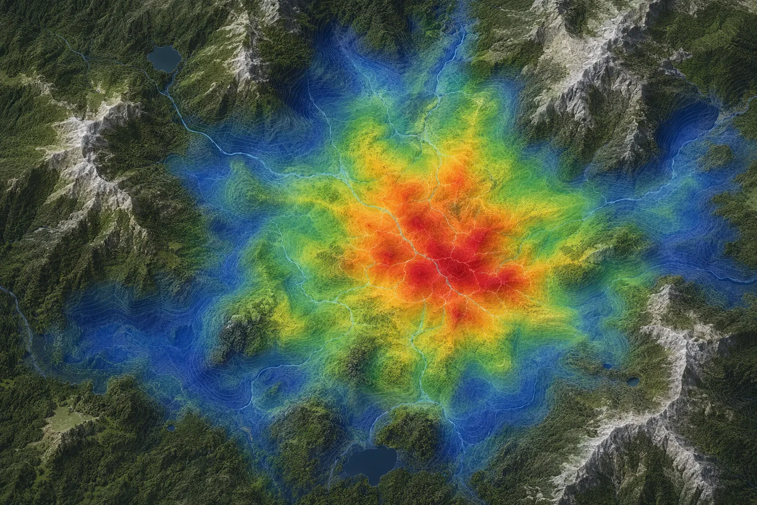
That comparison matters because lawnmower coverage is easy to understand and often comforting on a map, but lost people do not behave like uniformly distributed targets. They follow slopes, avoid or seek water, become disoriented, rest, backtrack, descend, or stop moving. A behavioral heat map does not guarantee a find. It gives command a more defensible way to spend scarce flight time and personnel time.
The Glasgow model and the Kennesaw State system could eventually support different points in the same operational chain. One helps decide where to look. The other attempts to interpret what the drone sees after a possible person is found. Neither piece, on the evidence available now, proves that an integrated AI system reduces time-to-treatment in real SAR deployments. The best current claim is narrower: separate research efforts show plausible gains in search prioritization and preliminary remote assessment.
| Capability | What it may change | Evidence status |
|---|---|---|
| Thermal human detection | Directs rescuers toward a possible person rather than continuing blind coverage | Operationally used in SAR examples, but not necessarily with AI triage |
| Behavioral probability heat maps | Prioritizes likely search zones before detection | Virtual-test evidence from University of Glasgow |
| Forehead segmentation and temperature extraction | May support early concern for abnormal thermal state | Research-stage Kennesaw State system |
| Consciousness estimation from imagery | May influence urgency and medical staging before contact | Research-stage and clinically unvalidated in real SAR deployment |
Thermal drones are already useful, but that is not the same as AI triage
Operational examples show why SAR teams are interested in drones without needing futuristic claims. Outside Online reported thermal drone use in a Weber County, Utah, Christmas 2022 dog rescue and in Teton County, Wyoming, swiftwater rescues in 2025.[2] These are useful deployment signals: teams are already putting thermal cameras into real incidents, and the equipment can improve what rescuers see when terrain, darkness, water, or distance makes ground search difficult.
But those examples should not be inflated into proof of integrated medical AI. A thermal camera that helps locate a subject is not the same as a validated system that estimates consciousness or classifies hypothermia. The operational bridge is still missing: a tested workflow in which drone imagery, AI inference, communications, incident command, and medical response all work together under field conditions.
That bridge is where many promising rescue technologies either become ordinary tools or remain conference demonstrations. The algorithm can be impressive and still fail to matter if the operator cannot maintain the link, if the drone cannot stay aloft long enough, if the model produces ambiguous alerts, or if regulations prevent the search pattern that the software recommends.
The bottleneck is not only accuracy
Connectivity deserves to sit near the center of any clinical review of AI drones. Most drones rely on radio frequencies that degrade in mountainous terrain. The Conversation notes that most drones do not have satellite internet; Starlink Mini is a possible portable option, but it weighs 2.56 lbs and adds cost.[1] In a wilderness mission, that weight is not an abstract specification. It competes with battery, sensor payload, endurance, portability, and what a field team can reasonably carry.
A model that requires stable high-bandwidth connectivity may perform well in demonstration and poorly in the canyon where it is most needed. If the inference runs onboard, the drone needs the compute capacity and power budget. If inference runs remotely, the link becomes part of the medical device chain in all but name. A broken link does not only interrupt video; it interrupts the reasoning that command may be waiting on.
Regulation is another structural limit. FAA visual-line-of-sight requirements and Scotland's 500 m operator limit constrain drone deployment. MIT Technology Review has also described beyond-visual-line-of-sight restrictions as a barrier for AI-directed drone search.[3] These rules matter clinically because missing people often are not conveniently inside visual range. Better AI does not by itself authorize a longer search leg, a ridge-to-ridge flight, or an autonomous sweep beyond the operator's permitted area.
The operator burden also grows as drones become more intelligent. Someone must decide whether an alert is credible, whether a temperature estimate is plausible, whether a still body-shaped object should trigger a medical escalation, and whether a false positive is worth diverting a ground team. In SAR, a false positive is not just a statistical error. It can move personnel away from another zone while the real patient continues to cool, bleed, dehydrate, or drift downstream.
- The output must be actionable: “search this drainage next” or “prepare for likely immobile hypothermic patient” is more useful than a vague anomaly.
- The system must tolerate partial views: canopy, clothing, rocks, water, snow, and terrain can all distort thermal interpretation.
- The workflow must define responsibility: command, drone operator, medical lead, and field teams need to know who acts on an AI alert.
- The communications plan must be realistic: radio degradation and payload tradeoffs cannot be solved by assuming perfect connectivity.
What would count as clinical progress
For emergency medicine and wilderness medicine, the next useful evidence is not another statement that drones can find heat signatures. The field needs prospective operational testing that measures whether AI changes time-to-location, time-to-contact, time-to-treatment, and the appropriateness of medical staging. It also needs error reporting in the conditions that matter: cold rain, heat, snow, canopy, night operations, steep terrain, water rescue, and long radio paths.
The medical layer should be validated against outcomes and field assessments, not just image labels. If a system estimates abnormal body temperature, what is the reference standard? If it estimates consciousness, how often is that estimate wrong, and in which direction? A false “conscious” label may reduce urgency when urgency is needed. A false “unconscious” label may divert resources, but it may also be tolerated differently depending on mission stage and available personnel. Those tradeoffs need to be explicit rather than hidden inside a single accuracy number.
The most promising version of the technology is not a fully autonomous rescue machine. It is a decision-support layer that narrows the search space, flags a probable person, extracts limited medical cues, and presents uncertainty clearly enough that experienced rescuers can decide what to do next. That is a high bar, but it is also a realistic one.
Bear attack evidence is a related computer-vision gap, not a validated use case
The bear attack evidence question needs a more restrained answer. Similar computer-vision methods may eventually help analyze wound patterns, scene photographs, tracks, clothing damage, or other visual evidence after an animal attack. But the available evidence does not identify a validated AI tool for bear attack forensic evidence analysis, and it would be misleading to imply that one currently exists.
This is not the same problem as drone triage. Wilderness rescue AI can be judged by whether it helps find and reach a living patient sooner. Bear attack evidence analysis would involve forensic standards, chain of custody, expert interpretation, species attribution, wound mechanism, and legal or wildlife-management consequences. A model that detects a human heat signature from the air does not automatically become a defensible tool for interpreting bite, claw, or scene evidence.
For now, the responsible position is simple: AI methods used in thermal detection and segmentation suggest a possible technical direction for future forensic image tools, but bear attack evidence remains an adjacent evidence gap. Any article, vendor claim, or procurement proposal that treats that gap as solved should be read with caution.
Where the category stands in 2026
AI-enhanced drones for wilderness rescue are plausible and technically promising. The strongest current evidence supports early-stage emergency medicine AI: human detection from thermal and infrared imagery, body-part segmentation, forehead temperature extraction, consciousness estimation, and behavioral search prioritization.[1][2] Those are meaningful advances because they target the part of rescue where uncertainty consumes time.
The category is not yet deployable clinical decision support. No integrated AI medical triage system has been validated in real operational SAR deployment, and the hardest barriers are partly outside the model: connectivity, payload, endurance, operator workload, terrain, false positives, and visual-line-of-sight regulation. For bear attack evidence, the state of the field is even narrower: no validated AI forensic tool is established by the available evidence. The honest label for this moment is research-stage emergency medicine AI with a promising rescue use case, not validated forensic analysis and not field-proven autonomous triage.
References
- Drones paired with AI could help search-and-rescue teams find missing persons faster, The Conversation
- The Future of Search and Rescue Involves AI and Drones, Outside Online
- AI-directed drones could help find lost hikers faster, MIT Technology Review
Comments
Join the discussion with an anonymous comment.