
The promise of AI-calibrated smoke monitoring is easy to like: a cheaper sensor on a wall, roof, school, or neighborhood clinic can show wildfire PM2.5 conditions much closer to where people actually breathe than a distant regulatory monitor. The harder question is whether the data reaches the people whose bodies and homes are least protected. On that point, the evidence is already uncomfortable. In a California study using more than 1,400 PurpleAir sensors, sensor owners lived in homes valued about 21% above the median value in their cities.[1]
That one finding should slow down any confident claim that low-cost monitoring is automatically democratizing wildfire smoke protection. The technology may be inexpensive compared with reference-grade monitoring, but ownership still follows money, housing, and neighborhood capacity. If monitors cluster where people already have more resources to respond, the map becomes sharper without necessarily becoming fairer.

This is the central tension in the health impacts of wildfire smoke and air quality monitoring with AI. Hyperlocal data can make exposure visible block by block. But visibility is not the same as protection, and sensor ownership is not the same as public health coverage.
The Monitoring Gap And The Housing Gap Are Connected
Liang and colleagues did more than document where sensors were located. Their study also examined how outdoor smoke moved indoors, which is where much of the public health advice around wildfire events becomes more complicated. Across the California PurpleAir network they studied, indoor PM2.5 tripled during wildfire events. The reported infiltration ratio fell from 0.42 on non-fire days to 0.23 on fire days, suggesting that people did reduce some exposure by being indoors, closing buildings, filtering air, or through other protective factors.[1]
But the average hides the housing problem. Newer buildings, especially post-2000 buildings, had significantly lower smoke infiltration than older buildings.[1] That matters because “go indoors” is not a uniform intervention. A well-sealed newer home with filtration is not the same refuge as an older rental unit with leaky windows, no mechanical ventilation, and no portable air cleaner. For a tenant in that second setting, the outdoor AQI map may say the danger is outside while the indoor air is already carrying the event into the bedroom.
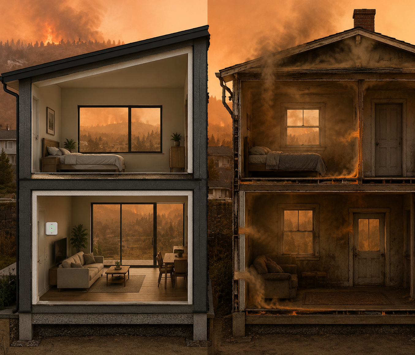
The adoption gap and the infiltration gap point in the same direction. The homes most likely to have a consumer monitor are not necessarily the homes where indoor exposure is hardest to avoid. A neighborhood can be both under-monitored and over-exposed, which is exactly the combination that public health surveillance is supposed to notice rather than reproduce.
There are limits to how far this single study can be generalized. It was a California-based analysis of PurpleAir sensor owners, not a national census of all low-cost sensor adoption. Still, the pattern is too relevant to treat as a niche observation. If a voluntary sensor network depends on who can buy, install, maintain, and connect a device, then the resulting exposure map will partly reflect household resources before it reflects community need.
The Health Burden Is Not Distributed Evenly
Wildfire smoke is not just an environmental nuisance that becomes visible in orange skies. Stanford experts described wildfire smoke as roughly 10 times more toxic than PM2.5 from fossil fuel sources, underscoring why a smoke-specific public health response cannot be treated as routine air pollution messaging.[2] Yale School of Public Health researchers estimated about 11,415 non-accidental deaths per year attributable to wildfire-smoke PM2.5 in the contiguous United States.[3]
The clinical burden also falls unevenly. Rappold and colleagues found that during wildfire episodes, counties with lower socioeconomic status experienced 85% more asthma emergency department visits and 124% more congestive heart failure emergency department visits per 100 μg/m³ increase in PM2.5.[4]
That does not prove that installing sensors would have prevented those visits. It does show why the monitoring gap is not merely a data-quality issue. When lower-SES communities have larger smoke-related emergency department increases, a monitoring network that underrepresents those same places risks making the highest-burden populations less visible at the moment decisions are being made.
Those decisions are practical and time-sensitive. A school district may decide whether to cancel outdoor activities. A county health department may decide where to distribute portable air cleaners. An employer may decide when wildfire smoke worker protections apply. A clinician may advise a patient with asthma or heart failure to change medication use, reduce exertion, or seek filtered indoor air. If the nearest reliable reading is miles away, the burden of uncertainty shifts onto the person with the least margin for error.
Low-Cost Sensors Help, But They Do Not Escape Calibration
Low-cost sensor networks exist because reference-grade monitoring is too sparse and expensive to answer every neighborhood-level smoke question. PurpleAir, Clarity, Aethair, and similar systems can be placed closer to homes, schools, workplaces, and community facilities. Their readings can feed dashboards, alerts, and models that translate particulate levels into risk estimates or recommended actions. AI correction can also help adjust raw sensor readings, identify outliers, and combine sensor data with meteorology and other inputs.
But correction is not magic. Berkeley Lab reported that low-cost home air quality monitors could over-report PM2.5 by 1.6 to 2.4 times during wildfire smoke events. The same work emphasized that correction factors improve usefulness but need calibration for the type of smoke and conditions being measured.[5]
That distinction matters for public health use. A resident deciding whether to turn on a portable HEPA unit may tolerate more uncertainty than an agency issuing a legally consequential order. A worker protection rule needs a threshold that people can understand and enforce. A health system targeting outreach to patients with chronic obstructive pulmonary disease, asthma, or heart failure needs enough confidence that the signal represents a real exposure difference rather than a device artifact.
AI-adjusted monitoring is most useful when the uncertainty is visible. A corrected reading should not be presented as if it were equivalent to a federal reference monitor in every circumstance. It can still be good enough for triage, community situational awareness, and targeted prevention if users know what the number can support and what it cannot.
What Has To Happen Between Measurement And Protection
The gap between a sensor reading and a health benefit is where many technology claims get too clean. Detection has to trigger something: a warning, a filter, a staffing decision, a school protocol, a housing inspection, a worker protection requirement, a clinic outreach list, or a public cooling-and-clean-air site with enough capacity to matter.
A more useful deployment logic starts with overlapping vulnerability rather than device enthusiasm. The priority areas are places where three conditions meet: high smoke burden, buildings that do not keep smoke out, and sparse or unreliable monitoring. In those places, a sensor is not a consumer gadget. It is part of the local evidence chain that lets someone justify action before emergency department visits rise.
| Weak deployment logic | Equity-weighted deployment logic |
|---|---|
| Place sensors where residents or institutions already request them | Place sensors where exposure, housing vulnerability, and health burden overlap |
| Treat the public map as the main product | Connect readings to alerts, filtration support, worker protections, and outreach |
| Emphasize device count | Emphasize coverage of under-monitored populations |
| Hide uncertainty behind a single corrected number | Show calibration limits and explain appropriate uses |
This is also where AI has a real role, as long as it is not oversold. Models can help merge dense sensor data with regional monitoring, flag sudden changes, estimate local exposure, and support risk communication. Adjacent work on AI translation of air quality data into health risk estimates and personalized wildfire smoke safety advice is most credible when it begins from exposure conditions and patient vulnerability, not from the assumption that every alert recipient can act in the same way.
A text alert telling people to stay indoors is weak protection for a home that leaks smoke. A dashboard warning is incomplete if workers cannot stop outdoor labor without wage loss or employer enforcement. A neighborhood-level smoke spike matters more when it is tied to a known list of high-risk buildings, homebound residents, outdoor workers, schools, shelters, and clinics.
Intentional Networks Are Already More Than A Theory
There are signs that low-cost monitoring is moving into more consequential public health and regulatory use. The EPA’s AirNow Fire and Smoke Map incorporates sensor data alongside regulatory monitors, giving the public a more granular view of smoke conditions than the older monitor network alone could provide.[6] Washington and California allow low-cost sensor readings as legally acceptable measurements to trigger worker protection requirements when AQI for PM2.5 reaches 151 or higher.[7][8]
Those are not small shifts. They move low-cost sensors out of the realm of hobbyist maps and into decisions that affect workers, agencies, and public communication. Oregon has also adopted wildfire smoke protections for workers, showing that smoke monitoring is becoming part of occupational health governance in the western United States.[9]
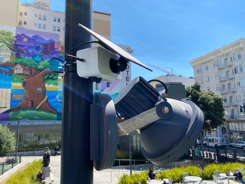
Community deployments point in the same direction. Brightline Defense has worked on air quality monitoring in San Francisco single-room occupancy settings, a context where residents may face both higher vulnerability and less control over building conditions. Boulder County’s post-Marshall Fire monitoring and Monterey Bay Air Resources District’s community air monitoring work also show that sensor placement can be planned around local exposure concerns rather than left to voluntary consumer adoption.[10][11][12]
These cases should be read as evidence of intentional design, not proof of completed disparity reduction. The available material does not establish that these deployments reduced asthma visits, heart failure exacerbations, mortality, or other health outcomes. What they do show is the necessary first step: someone decided that the places missing from the map deserved to be measured.
The Adoption Paradox Is A Governance Problem
Consumer adoption can expand a network quickly, but it cannot decide what public health equity requires. That decision belongs to health departments, air districts, worker safety agencies, school systems, housing authorities, community organizations, and funders. If they use the existing sensor map as a neutral picture of need, they inherit its bias. If they use it as a partial picture and fill the gaps deliberately, the same technology becomes much more useful.
The practical questions are not especially glamorous. Who installs and maintains the device? Who checks whether it stays connected? Who explains the uncertainty to residents without making the data unusable? Who pays for filters when the reading is high? Who has authority to change work practices, open cleaner-air spaces, or prioritize outreach to medically fragile patients?
For public health teams, the better map is only the start of the response. A high reading near older multifamily housing should prompt a different response than a high reading in a neighborhood where most homes are sealed and filtered. A smoke plume over a farmworker community should not be treated as merely an atmospheric event. A school-adjacent monitor should be connected to decisions adults can make before children are outside breathing harder during recess or sports.
The strongest case for AI-calibrated low-cost sensors is therefore conditional. They can close wildfire smoke exposure gaps when networks are deliberately placed where health burden, housing vulnerability, and lack of monitoring overlap, and when readings are tied to protective action. Without that targeting, better maps may simply become another way affluent communities see danger sooner.
References
- Using low-cost sensors to quantify the effects of air filtration on indoor and personal exposure relevant to wildfire smoke, PNAS, 2021. https://www.pnas.org/doi/10.1073/pnas.2106478118
- Assessing wildfire health risks, Stanford Report, January 2025. https://news.stanford.edu/stories/2025/01/assessing-wildfire-health-risks
- Long-term exposure to wildfire smoke associated with higher risk of death, Yale School of Public Health. https://ysph.yale.edu/news-article/long-term-exposure-to-wildfire-smoke-associated-with-higher-risk-of-death/
- Cardio-respiratory outcomes associated with exposure to wildfire smoke are modified by measures of community health, Environmental Health, 2012. https://ehjournal.biomedcentral.com/articles/10.1186/1476-069X-11-71
- Low-cost home air quality monitors prove useful for wildfire smoke, Berkeley Lab, 2020. https://newscenter.lbl.gov/2020/08/18/low-cost-home-air-quality-monitors-prove-useful-for-wildfire-smoke/
- Fire and Smoke Map, AirNow. https://fire.airnow.gov/
- Wildfire smoke emergency rules, Washington State Department of Labor & Industries. https://www.lni.wa.gov/safety-health/safety-topics/topics/wildfire-smoke
- Protection from Wildfire Smoke, California Department of Industrial Relations. https://www.dir.ca.gov/title8/5141_1.html
- Oregon OSHA Wildfire Smoke, Oregon Occupational Safety and Health Division. https://osha.oregon.gov/Pages/topics/wildfires.aspx
- Community air monitoring initiatives, Brightline Defense. https://brightlinedefense.org/
- Marshall Fire air quality monitoring, Boulder County. https://bouldercounty.gov/
- Community air monitoring, Monterey Bay Air Resources District. https://www.mbard.org/
Comments
Join the discussion with an anonymous comment.