
Using air quality monitoring for wildfire smoke health safety begins with an uncomfortable clinical fact: the same PM2.5 number does not always carry the same health meaning. In wildfire seasons, a regional air quality alert may arrive after smoke has already moved through a neighborhood, after a child with asthma has started coughing, or after an older adult with COPD has crossed from mild dyspnea into an urgent visit. The monitoring question is no longer simply whether smoke is present. It is whether the right people can see the risk early enough, locally enough, and with enough confidence to act.
That distinction matters because wildfire PM2.5 appears to be more damaging to respiratory health than PM2.5 from non-wildfire sources. Aguilera and colleagues reported that wildfire-specific PM2.5 was up to 10 times more harmful for respiratory hospital admissions than non-wildfire PM2.5 in Southern California, a finding that gives smoke monitoring a clinical urgency beyond ordinary environmental surveillance.[1] A countywide air quality index can still be useful, but it is a blunt instrument for a pollutant whose health signal may be steep, local, and fast-moving.
The population-level burden is also large, although the most arresting estimates should be read with their methods in view. A 2024 PNAS analysis associated long-term smoke PM2.5 exposure with about 11,415 nonaccidental deaths per year in the contiguous United States, using modeled smoke PM2.5 concentrations and assuming causality in the mortality assessment.[2] That does not make the estimate disposable; it makes it a strong signal that depends on modeling choices. For clinicians and public health teams, the practical conclusion is narrower and more useful: smoke exposure is not a nuisance variable, and delayed or spatially coarse monitoring can leave preventable risk unmanaged.
Pediatric data make the timing problem harder to ignore. A 2025 review summarized evidence linking wildfire smoke exposure to a 13% increase in asthma emergency department visits and a 21.8% increase in cough per 10 ug/m3 of wildfire PM2.5.[3] Those measures are not the same outcome, and they should not be collapsed into a single estimate of harm. Together, though, they point toward the same operational need: when smoke risk rises, pediatric practices, school health staff, respiratory therapists, and emergency departments need information before the surge is visible at the front desk.
Why ordinary monitoring often arrives too late
Traditional air quality monitoring was built primarily for measurement, compliance, and public reporting. Those functions remain important. Regulatory-grade monitors provide the stable ground truth that newer systems depend on. The clinical difficulty is that a sparse monitoring network can miss the difference between a valley floor, a ridgeline community, a neighborhood beside a roadway, and a rural clinic downwind of a fire perimeter.
A patient does not breathe the county average. A child walks to a bus stop, an older adult opens a window at night, a farmworker spends hours outdoors, and a clinic receives calls from patients who are looking at different apps showing different numbers. In that setting, a public alert that says air quality is unhealthy somewhere in the county may be accurate and still insufficient for health safety.
This is where artificial intelligence and machine learning become clinically interesting. Not because an algorithm is inherently safer than an air monitor, but because models can combine imperfect, scattered observations into a more continuous estimate of where smoke is, where it is going, and which populations may be more exposed or more vulnerable.
The AI monitoring stack is changing the unit of action
The technical literature has moved quickly. A systematic review published in Environmental Modelling & Software examined 65 Q1 journal articles and found that machine learning methods now dominate the air pollution monitoring and forecasting research landscape; within that literature, Random Forest models achieved prediction accuracy as high as 98.2% for pollutant concentrations.[4] That figure is a sign of technical momentum, not a guarantee of clinical safety. Prediction accuracy depends on the pollutant, setting, inputs, validation design, and ground-truth data used to test the model.
The more clinically meaningful change is the shift in what monitoring can produce. Instead of one official monitor reporting a delayed or averaged value, an AI-enhanced system may ingest regulatory monitors, low-cost sensors, satellite observations, mobile measurements, fire inventories, meteorology, land-use information, and demographic overlays. Random Forest and Gradient Boosting models can be useful when the task is estimating pollutant concentrations from many structured environmental predictors. LSTM networks become relevant when the problem is temporal: smoke today is partly explained by smoke, wind, emissions, and atmospheric behavior in the preceding hours or days.
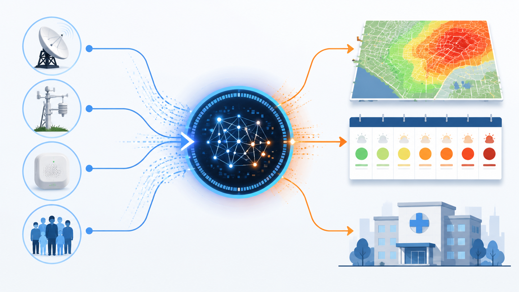
For a health system, the output that matters is not the elegance of the model class. It is whether the system changes the unit of action from a broad regional advisory to a time-updated risk estimate for specific neighborhoods, service areas, or patient groups. A respiratory clinic can do something with a credible estimate that smoke risk will rise tomorrow morning in the ZIP codes where its highest-risk asthma patients live. A generic alert across a whole region is harder to translate into staffing, outreach, or care deferral.
| Monitoring function | Conventional output | AI-enhanced output | Clinical planning implication |
|---|---|---|---|
| Current smoke measurement | Sparse monitor readings or county-level AQI | Interpolated neighborhood-level PM2.5 estimates | More targeted patient messaging and clinic awareness |
| Short-term tracking | Reactive public alert after conditions worsen | Frequently updated local risk maps | Earlier preparation for asthma and COPD call volume |
| Sub-seasonal anticipation | Limited visibility beyond near-term forecasts | Emissions forecasts weeks ahead | Potential pre-positioning of staff, supplies, and outreach |
| Equity assessment | Exposure reported without local vulnerability context | Risk maps layered with demographic information | Identification of neighborhoods where exposure and vulnerability overlap |
From reactive alerts to weeks-ahead planning
The most important forecasting work is the kind that buys time. In January 2026, a CIRES/NOAA team described an AI system that combines seven global fire emission inventories to predict wildfire emissions 35 to 45 days in advance.[5] That is a different category of usefulness from a same-day smoke map. A 35- to 45-day signal is not a patient instruction, and it is not a diagnosis. It is a planning interval.
With that interval, a public health department could prepare outreach for communities that repeatedly experience high smoke exposure. A primary care network could identify panels of patients with asthma, COPD, heart failure, or high-risk pregnancy who may need medication checks, action plans, or communication in advance of a severe smoke period. A hospital could review respiratory staffing, pharmacy inventory, and elective scheduling assumptions. A school district could coordinate with health officials before outdoor events are already underway.
The clinical value of such a forecast depends on how the warning is connected to an intervention pathway. If no one owns the response, a 45-day forecast is only an impressive early signal. If a care team has defined thresholds, patient lists, messaging templates, and escalation rules, the same signal could become operational infrastructure. The evidence base has not yet shown that this pathway reliably improves outcomes, but the temporal window is exactly the kind clinicians have been missing.
Near-real-time risk maps are clinically attractive, with an important caveat
A 2025 Scientific Reports framework shows why AI-enhanced smoke monitoring is drawing attention from health researchers. The proposed system integrates fixed sensors, mobile monitors, satellite data, and demographic overlays to generate health risk maps updated every 5 minutes, with SHAP-based interpretability to help explain which features are contributing to the model output.[6] That design addresses several practical frustrations at once: static maps, isolated sensors, unexplained risk scores, and environmental data that sit apart from population vulnerability.
The caveat is not small. The framework is a proof of concept using synthetic data.[6] It should be read as a prototype of a monitoring architecture, not as evidence that a deployed system can safely guide patient-level decisions during a real wildfire event. Synthetic data can help test workflows, model behavior, and visualization logic. It cannot substitute for validation against messy, missing, biased, and geographically uneven real-world observations.
Still, the architecture is worth unpacking because it points toward the kind of system healthcare would actually need. Fixed monitors contribute stable reference points. Low-cost sensors add density, especially where regulatory monitors are sparse. Mobile monitors can detect gradients that stationary devices miss. Satellite inputs extend visibility across large regions. Demographic overlays help distinguish a smoke plume over a low-density area from the same plume over a neighborhood with many children, older adults, outdoor workers, or residents with limited access to care.
Interpretability also matters. A risk map that cannot explain itself is difficult to use in clinical operations. SHAP-based methods do not make a model correct, but they can show whether a high-risk estimate is being driven by sensor readings, satellite-derived smoke signals, meteorology, or demographic vulnerability.[6] That distinction can change the response. A high concentration estimate may call for exposure reduction messaging; a vulnerability-weighted risk estimate may call for outreach through clinics, schools, home health programs, or community organizations.
What a care team could do with better smoke intelligence
The strongest near-term case for AI-enhanced wildfire smoke monitoring is not automated individual triage. It is better preparation by humans who already manage respiratory risk. A pediatric practice may use credible local forecasts to send asthma action plan reminders before a smoke episode rather than after parent calls begin. A COPD clinic may review rescue inhaler access and oxygen contingency planning for high-risk patients. A health system may decide when to expand nurse advice line capacity or respiratory therapy coverage. A public health department may prioritize clean-air shelter messaging in neighborhoods where smoke exposure and vulnerability overlap.
Those uses are plausible because they convert monitoring into preparation. They are not yet proven because the chain from model output to patient outcome has many weak links. A forecast must be accurate enough. The alert must reach the right organization. Someone must decide the threshold for action. The message must reach the patient in a language and channel they use. The patient must be able to act, which may require medication access, transportation, indoor filtration, paid leave, or a place to avoid smoke.
This is where rural patients deserve particular attention. Hyperlocal modeling sounds most persuasive in dense sensor environments. Rural areas may have fewer ground monitors, fewer low-cost sensors, longer distances to care, and less redundancy when a clinic is short-staffed. A model can fill spatial gaps statistically, but the uncertainty is not evenly distributed. If rural estimates are less anchored to ground-truth data, a clean-looking map may conceal exactly the uncertainty that matters for patients with the fewest alternatives.
The validation boundary is clinical, not just technical
High model performance in air pollution prediction is encouraging, but clinical adoption requires different questions. Was the model validated against independent ground measurements? Does it perform during extreme smoke events, when sensor behavior and atmospheric chemistry may differ from routine days? Does it work outside the region where it was trained? Does it preserve accuracy in rural areas and complex terrain? Does the output remain useful at the time scale when a clinic or public health team can still act?
Low-cost sensor networks illustrate the gap between coverage and certainty. Networks such as PurpleAir can increase spatial density, but the caveat is clear: strong correlation with regulatory monitors depends on smoke-specific correction, and county-wide averages can obscure clinically meaningful local variability. For wildfire smoke health safety, a sensor network is not merely a larger number of dots on a map. It is a measurement system that has to be corrected, calibrated, and interpreted under smoke conditions.
Ground truth is the recurring constraint. Satellite data may see broad smoke patterns, but surface-level exposure is what patients breathe. Mobile monitoring can reveal local gradients, but it may not be continuous. Regulatory monitors are reliable, but sparse. Low-cost sensors are dense, but require correction. Machine learning can combine these signals, yet the model is only as clinically trustworthy as the data and validation strategy behind it.
Technical readiness does not equal patient-level readiness
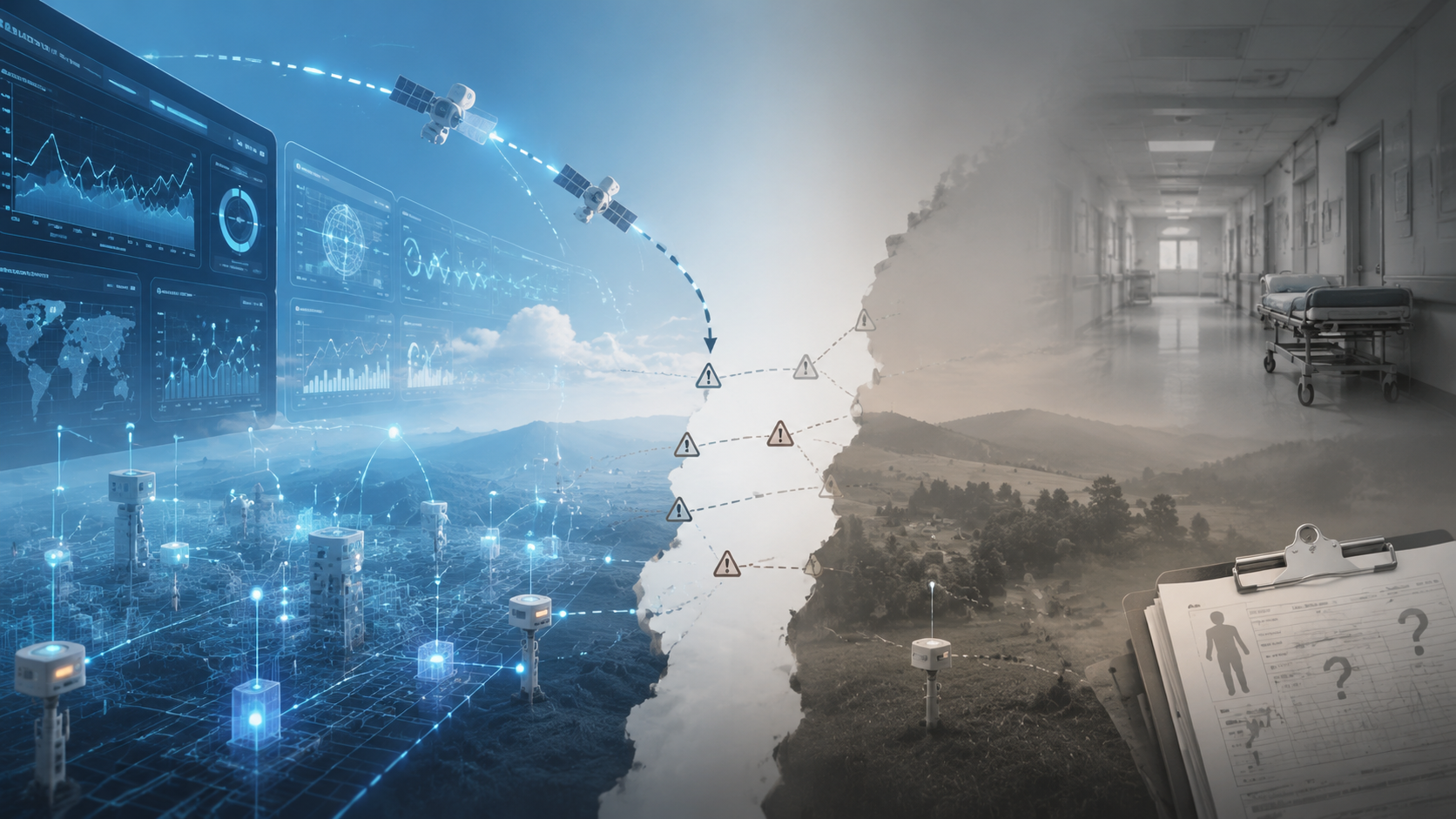
A useful distinction is technical readiness versus clinical readiness. Technical readiness asks whether the system can estimate or forecast smoke-related pollution with acceptable performance. Clinical readiness asks whether using that estimate changes decisions in a way that improves health, reduces avoidable visits, or protects vulnerable patients without causing new harms.
At the technical layer, the evidence is moving quickly. The systematic review of 65 Q1 articles, the high reported Random Forest performance, the CIRES/NOAA sub-seasonal emissions forecast, and the Scientific Reports risk-mapping framework all support the conclusion that AI-enhanced monitoring is becoming a serious environmental health infrastructure.[4][5][6] At the clinical layer, the evidence is thinner. The available materials do not establish that AI-driven wildfire smoke monitoring has prospectively improved asthma control, reduced COPD exacerbations, prevented emergency visits, or lowered mortality.
That does not make the technology premature for every use. Public health planning, situational awareness, resource allocation, and targeted communication can reasonably evolve before randomized patient-level evidence is complete. But it does mean that an AI smoke risk score should not be treated as a stand-alone clinical decision rule. It is better understood as an input into a governed response system, with thresholds, uncertainty communication, equity checks, and human accountability.
What evidence would make the next step safer
The next evidence threshold is not another abstract demonstration that machine learning can estimate PM2.5. The field needs validation that follows the clinical chain. A model should be tested against real ground measurements during wildfire episodes, including rural and low-density areas. Low-cost sensor correction should be smoke-specific and transparent. Forecast outputs should include uncertainty that a clinic or health department can understand. Risk maps should be evaluated for whether they identify communities that actually experience higher exposure and higher health burden.
Most importantly, intervention studies need to ask what happens after the alert. If an AI-enhanced system predicts a high-risk smoke period, does proactive outreach increase controller medication availability, reduce symptom days, shift care from emergency departments to planned contacts, or improve protection for children and older adults? If it triggers staffing changes, does that reduce wait times or prevent delayed care? If it recommends neighborhood-level messaging, does the message reach patients who are not already well served by digital health tools?
There is also a governance question. A health system adopting these tools would need to decide who reviews the forecast, who approves patient messaging, who updates thresholds, who monitors false alarms and missed events, and who is responsible when the model is uncertain. Those tasks are not glamorous, but they determine whether predictive monitoring becomes care infrastructure or another dashboard competing for attention during a crisis.
Where the evidence stands in Q3 2026
AI is improving air quality monitoring for wildfire smoke by making it more spatially granular, more temporally useful, and more capable of combining environmental and demographic signals. The most promising systems move beyond passive measurement toward predictive risk mapping: where smoke is likely to be, when it may arrive, and which communities may bear the greatest health risk.
For health safety, that is a meaningful advance. Wildfire PM2.5 has a disproportionate respiratory signal, modeled mortality burdens are substantial, and pediatric respiratory findings show why delayed alerts are clinically costly.[1][2][3] The technical foundation is also real: machine learning methods are now central to air pollution monitoring research, and emerging systems can integrate sensors, satellites, mobile data, fire inventories, forecasts, and population overlays.[4][5][6]
The adoption boundary is equally clear. Sparse rural ground-truth data, unresolved smoke-specific correction for low-cost sensors, county averages that hide local risk, prototype frameworks using synthetic data, and the absence of prospective outcome studies all limit patient-level use. In Q3 2026, AI-enhanced wildfire smoke monitoring is becoming clinically relevant infrastructure for public health and healthcare planning. It is not yet a validated basis for individual patient-level decisions.
References
- Wildfire smoke impacts respiratory health more than fine particles from other sources: observational evidence from Southern California — Nature Communications, 2021
- Long-term exposure to wildfire smoke PM2.5 and mortality in the contiguous United States — PNAS, 2024
- Wildfire smoke threatens children’s health, Stanford Medicine-led review finds — Stanford Report, January 2025
- Application of artificial intelligence in air pollution monitoring and forecasting: A systematic review — ScienceDirect, 2025
- Artificial intelligence takes on wildfire emissions: A new frontier in forecasting — CIRES, January 2026
- Machine learning-driven framework for realtime air quality assessment and predictive environmental health risk mapping — Nature Scientific Reports, 2025
Comments
Join the discussion with an anonymous comment.